
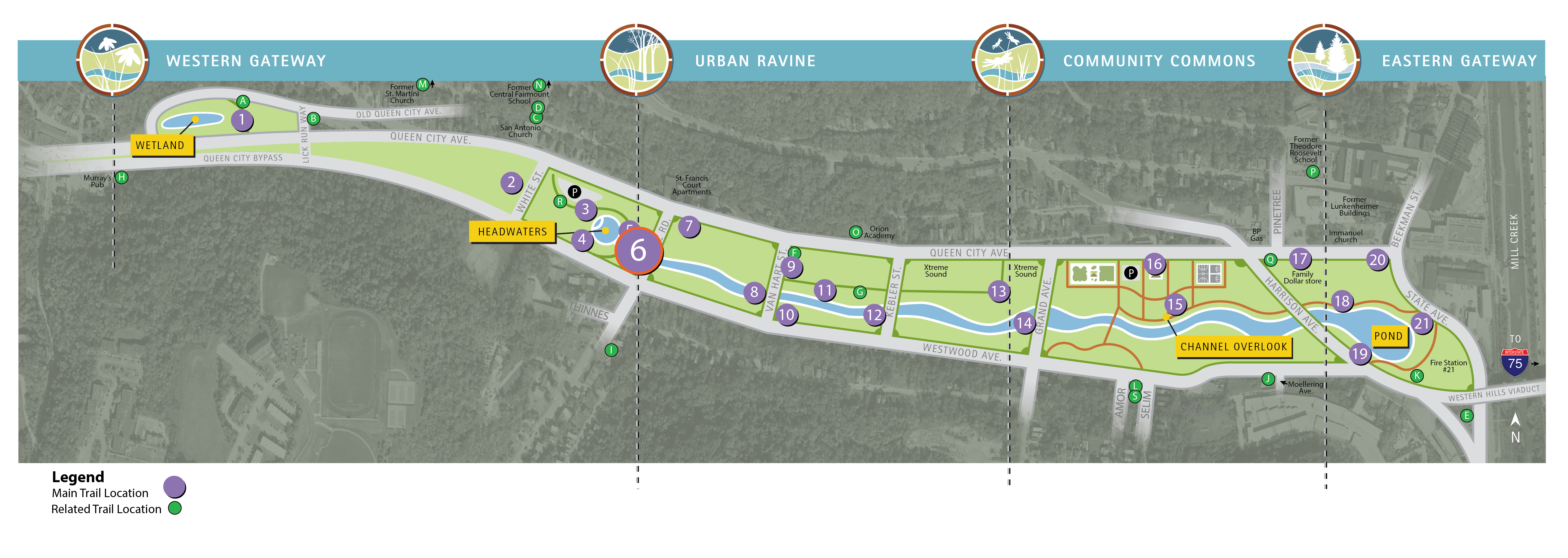
Trail Location 6: Reconnecting the Water Cycle (Stream Channel)
Click on the map for full image.
Walking Tour? View the trail locations in Google Maps.
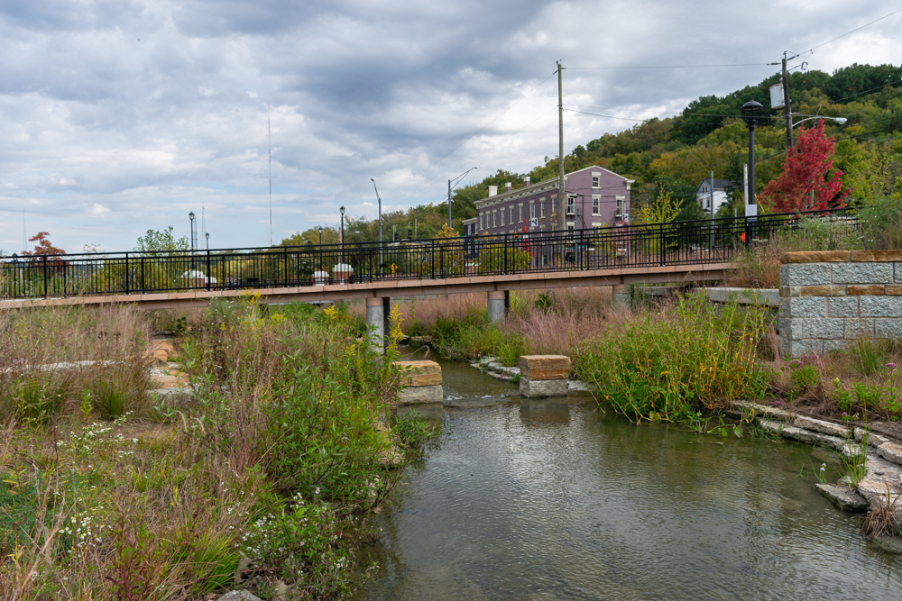
Lick Run Greenway stream channel, just west of the Headwaters
The Lick Run Greenway stream meanders for about a mile from the Headwaters at Quebec Road to the pond east of Harrison Avenue. It was designed to mimic a natural waterway.
Along its journey, the stream passes under five bridges at Quebec Road, Van Hart Street, Kebler Road, Grand Avenue, and Harrison Avenue, as well as a pedestrian bridge in the recreational area.
There are walking/biking paths along portions of the stream channel for the public to enjoy. In addition, wading is allowed in the stream between the Grand and Harrison avenue bridges.
The stream was constructed using limestone from quarries in Ohio and Batesville, Ind. Additionally, some of the rocks in the channel were salvaged from the foundations of former homes in South Fairmount. And that rock came fro the original Lick Run stream channel.
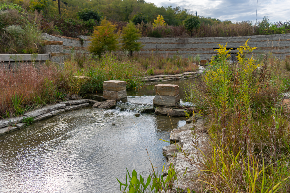
Pool, riffle, and run in the stream.
What can you see?
- Pools: Pools are pockets of deep, slow-moving water that allow sediment to settle.
- Riffles: A riffle is a shallow area of the stream with fast, turbulent water that breaks over rocks.
- Runs: Runs are swifter, deeper parts of a stream usually located downstream of a riffle.
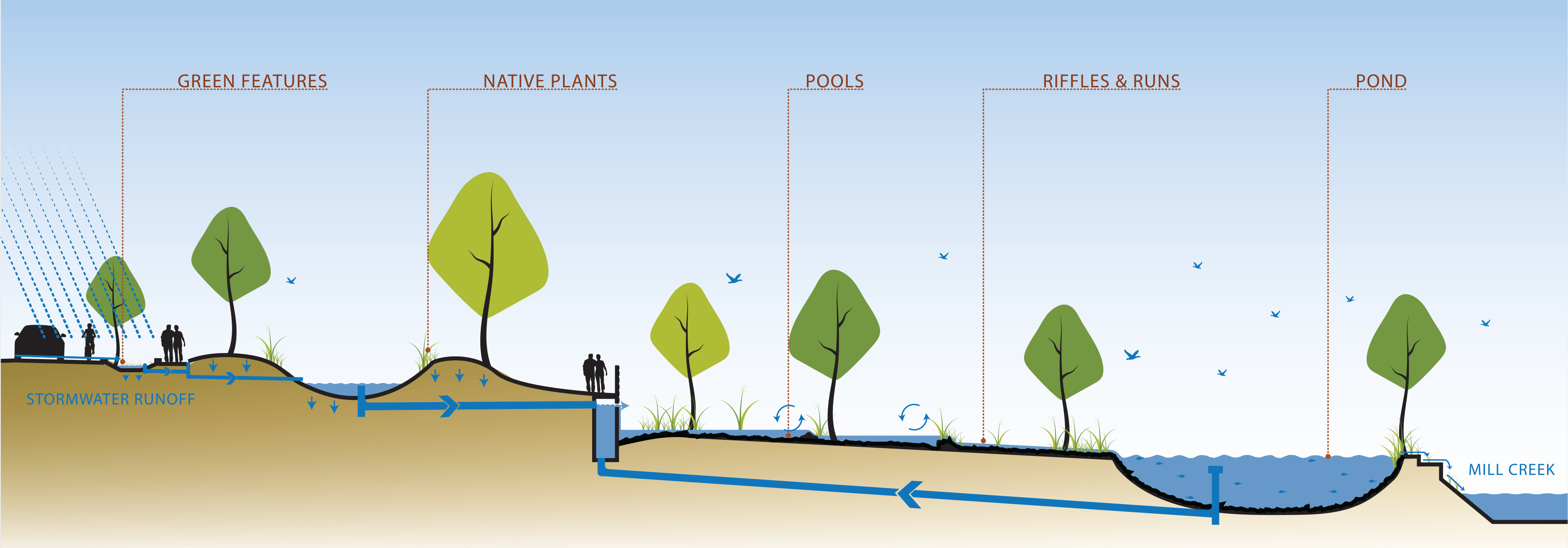
- Native plants: The plants in and around the stream are native, which means they originally grew in this area and are accustomed to our weather (so they don't need a lot of extra watering and care).
- Stormwater Planters: Green features like rain gardens and tree planters help soak up and clean rainwater. Tree planters can be found along Queen City Avenue and rain gardens can be found through the Lick Run Greenway.
Lick Run Greenway